This Going-to-the-Sun Road was forged in the 1930s with the many workers in the Civilian Conservation Corps (CCC). This bridge reminded me of other CCC projects. It was near the entrance on the St. Mary's River. (If you don't get out of the car and look back, you will miss it.)

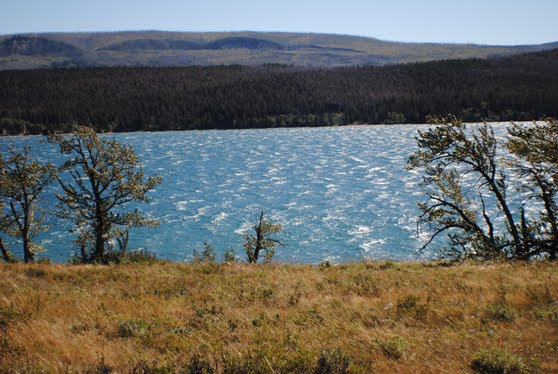
The wind whipping out of Logan's Pass causes the east side to be much windier, especially down at St. Mary's Lake, which looked very choppy.
Our first glimpse of the historic Red Buses of Glacier National Park.

These are one of the icons associated with the park (along with the mountain goats). We were fortunate to get a tour with Larry Perry the next day in one of the buses that had been relegated to the Smithsonian after it wore out, before Ford Motors and some other companies found a way to economically refurbish them. More about that in another blog!
We saw that several of the Red Buses had pulled over at a spot, so we did, too. You've heard the expression about something taking your breath away. When I came around the trees and looked out at Wild Goose Island and the mountains surrounding St. Mary's Lake. Apparently, I'm not alone, because I read or heard somewhere that this is the most photographed spot in the park.

There were a number of wildflowers blooming. Here are a few, although I can only identify the first ones--Indian Paintbrush.


Actually, the one on the left below is a Showy Daisy (or Aspen daisy in some books).


We stopped between the first and second construction flagmen (notice the construction area on the left side of the photo) to take photos of Siyeh Creek, downstream. As we entered the park, we saw signs that Logan Pass was closed from 9 p.m. to 7 p.m. Mondays through Thursdays. Our thought was, why would anyone want to be on this road in the dark?

Here's the view of Siyeh looking upstream.

Just before the east-side tunnel, we were stopped for construction again. I got out of the car and ran across the road to quickly take some shots. (A super-friendly construction worker gave me the heads up when the last car was coming down the mountain, so I got back in the car just in time.) Not the sharpest photo, but the wind was really whipping and I didn't have time for a tripod.

This tunnel was more picturesque than the one on the west side of the mountain--minus all the construction paraphernalia. But I was glad that the park is keeping up the road so that we can see these beautiful views.

The parking lot at Logan Pass was full, so my hubby stayed with the illegally parked car. (He found a group from Washington State to talk with and didn't mind at all.) This photo was taken from the sidewalk near the visitors center. Our car was at the opposite end of the parking lot.

It was very windy on the pass and I didn't take out the tripod, so the shots probably aren't as sharp as they could be. The next two views were taken looking eastward.


I wasn't able to climb the trails beside the Visitors Center to see what views there were then. Had expected to come back on the road again, but didn't get to. Oh, well--next time! (And there WILL be a next time!)
As I said earlier, going down the western side, we were limited in where we could stop. These shots were taken through the windshield or the driver's side window (past my hubby who was driving). Here you can see the Going-to-the-Sun Road hugging the curves of the mountainsides.

In this one I got a little of the window, but left it in to show I'm telling the truth about how I got the photo. The places where you can see the rock strata, the snow is new. In the places where it's thick and white, the snow probably has been there since the spring snowfalls. You can't see but a couple glaciers anymore on the American side, so it was nice to be able to see the snow packs. But it will always be Glacier National Park because they still are what carved these beautiful mountains.

While the car was stopped for another flagman, I jumped out and snapped these harebells.

Bird Woman Falls drops 492 feet. This is the view up the mountain, but it continues far below. Bird Woman is the Americanized name for Sacajawea, the Shoshoni woman who helped Lewis and Clark on their 1804 expedition.

We stopped at Lake MacDonald to mail postcards and took this photo, but the lighting wasn't great. Didn't get any "mirror" lake images because the wind was always too strong.

Next up, our Red Bus tour on Sept. 2 to Two Medicine Lake, which included a boat ride and a nature walk to Running Eagle Falls. I hadn't heard of Running Eagle before, but she sounds like quite a warrior (and horse acquisitions expert, to put it nicely).
No comments:
Post a Comment